See also my deep-dive on Koto-ku’s canals and lumber industry: The floating world of floating logs: the kiba of Koto-ku

Map 1: Koto-ku Shitamachi rivers and canals 下町河川の概要 (source)
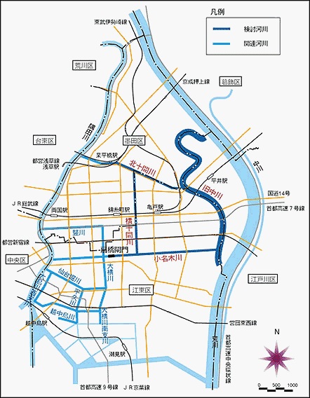
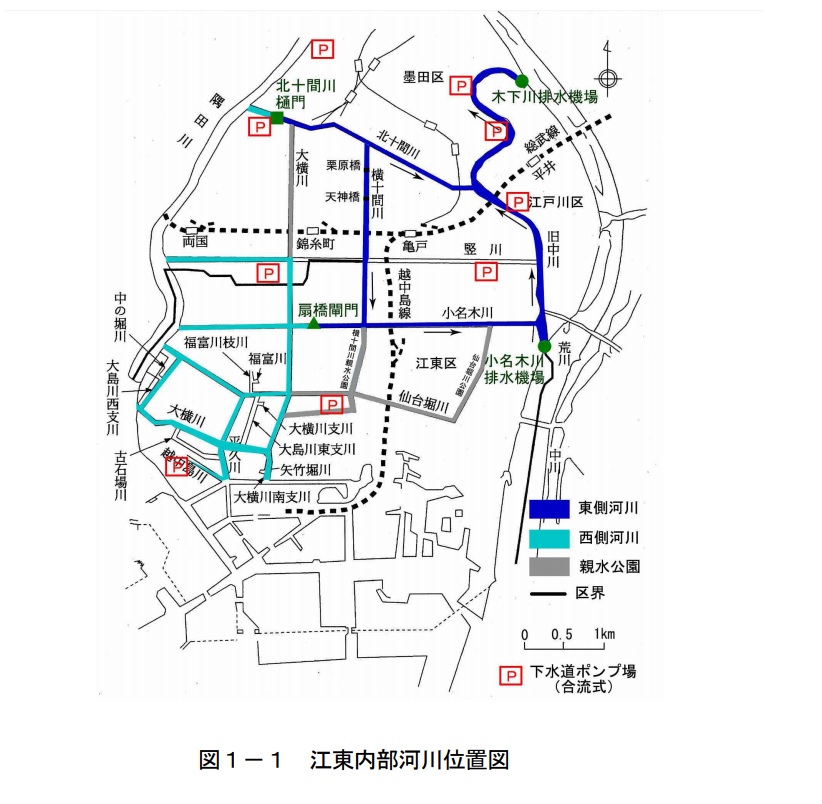
There are eleven rivers that together form the Koto Interior River 江東内部河川 (source); they are:
- 旧中川 Old Nakagawa River (Kyu-Nakagawa)
- 大横川 Ooyokogawa
- 大島川西支川 Ooshimagawa Nishi-Shisengawa
- 大横川南支川
- 北十間川 Kitajikkengawa
- 横十間川 Yokojikkengawa (I believe)
- 仙台堀川 Sendaiborigawa
- 平久川 Heikyugawa (I believe)
- 小名木川 Onagigawa (appears as ‘Konaki River’ per Google Maps)
- 竪川 Tatekawa
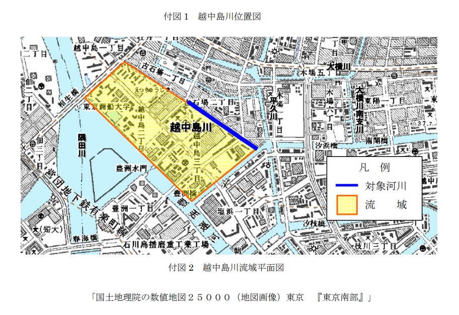
- 越中島川 Etchūjimagawa
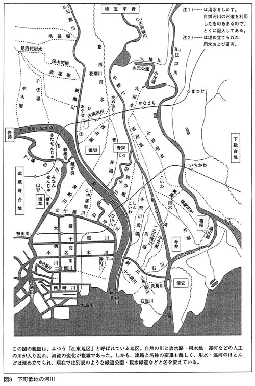
Map 2: from 図説 江戸・東京の川と水辺の事典 Dictionary Encyclopedia of Rivers and Watersides in Edo / Tokyo
Koto-ku is represented in the quadrant in the lower-left of the map.
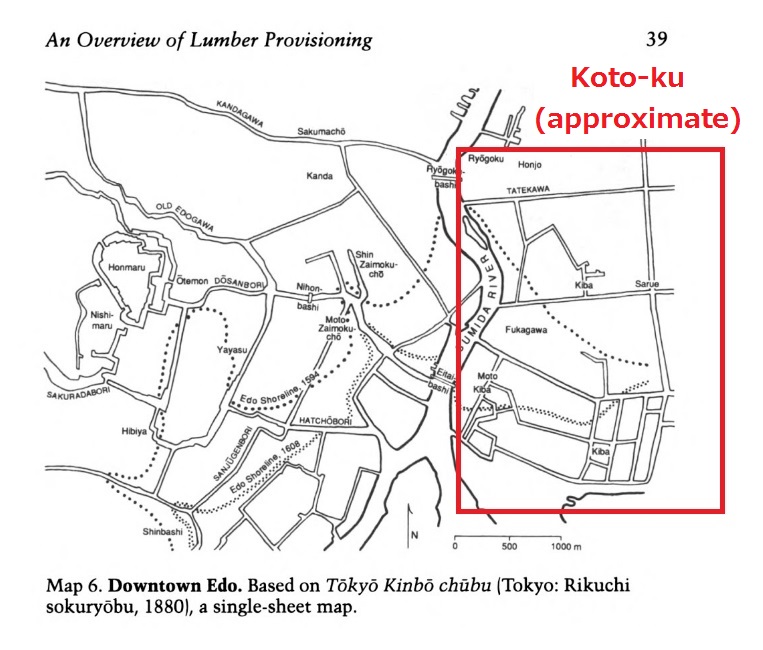
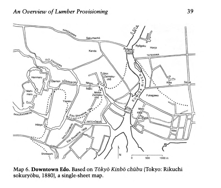
Map 3: from The Lumber Industry in Early Modern Japan
Tokyo, circa 1880″
Map 4: Detail of the Etchujimagawa River 越中島川 (#11 in the list of interior rivers) (source)
Map 5: One more version of the Koto Interior River map 江東内部河川位置図 (source)
Map 6: Historical photos of Koto-ku (source)

See also:
- Koto-ku walking map: Clover Bridge, Onagigawa River, & Higashi-Ojima
- Elevation and flood maps of Tokyo
- Koto-ku tourism: Lucky Dragon boat and atomic tourism
- Canals of the Ginza: floating through time on Tokyo’s central waterways
- Lumberyards on the Takekawa in Honjo (Hokusai woodblock print)
- Nakagawa Funabansho Barge Museum 中川船番所資料館 /江東区中川船番所資料館
- Kiba lumber ponds of Koto-ku, 1946 map

[…] visited the The Center of the Tokyo Raid and War Damages museum in Tokyo’s Koto-ku ward 江東区, located in the center of the fierce March 9-10 attack. The center’s […]
[…] Maps: Koto-ku rivers and canals 江東内部河川地図 […]
[…] Maps: Koto-ku rivers and canals 江東内部河川地図 […]
[…] Maps: Koto-ku rivers and canals 江東内部河川地図 […]
[…] it has steadily been augmented over the centuries by extensive land reclamation. The following map shows the boundaries of the shoreline as it was in 1594 and in 1608, as compared to 1880. The […]