I recently wrote an article for Metropolis Magazine, which can be read here: THE “HIGH LINES” OF TOKYO: A guide to the city’s hidden railway parks
There is a lot of information that I wasn’t able to fit in the article (for space reasons), so I’m sharing it below:
1) Miyashita Park 宮下公園 (Shibuya skate park, etc.)
Although Miyashita Park is not built on top of old train tracks, I’ve included it because of its central location and comprehensive “programming“, which included a skate park, climbing wall, and footsal court. Built on top of a parking garage just north of Shibuya Station, Miyashita park was a linear and elevated space. You can take a virtual tour of the old park in the linked Google Streetview photo-sphere; or this other photo-sphere, taken at night. As of 2017 the park began a radical redesign that will be completed in August, 2019. See: Future Tokyo: the new Miyashita Park, Shibuya 宮下公園

2) Yokohama Waterfront & Kishamichi Promenade 汽車道 / 山下臨港プロムナード / Yamashita Rinko Lines Promenade 山下臨港線プロムナード
The most notable elements of this path is the bridge and small islands, and the elevated train tracks, which you can navigate via Google Streetview. Here is a list of things to see and do as you make your way from Sakuragicho Station towards Yamashita Park.
- First section: Kishamichi Promenade Bridge 汽車道
- Second section: Yamashita Rinko Lines Promenade 山下臨港線プロムナード
- Akarenga Red Brick Warehouse
- Elephant’s Nose Pier Park ピア象の鼻 – from here there’s a wonderful view of the raised train tracks (Google Streetview)
- Osanbashi Yokohama International Passenger Terminal 大桟橋埠頭
- NYK Hikawamaru (former ocean liner)
- Links:

3) Log Road Daikanyama ログロード代官山 (Shibuya)


This path is built on the site of the old Toyoku Line tracks, which have since been buried underground. At the southern end of the Log Road, closer to Daikanyama Station, is Spring Valley Brewery, owned by macro-brewer Kirin, this is a spacious facility and a fun place to while away a lazy afternoon.
Links:
- Log Road Daikanyama (TimeOut Tokyo)
- It’s all change at Shibuya Station for the Toyoko Line (Japan Times, 2013)
- Park life: Tokyo, the latest city to get a high line (The Guardian)
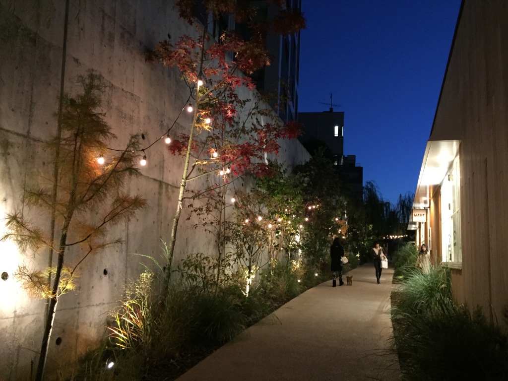
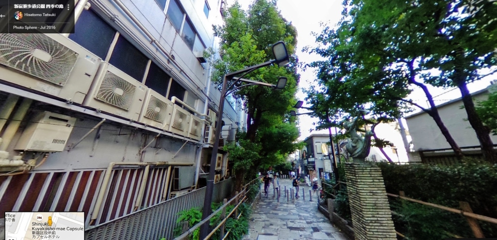
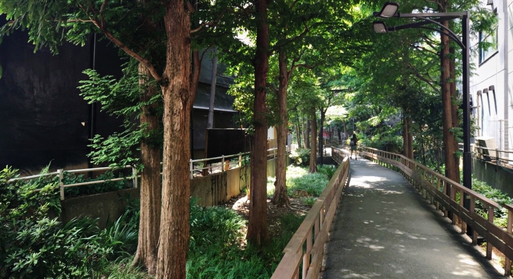
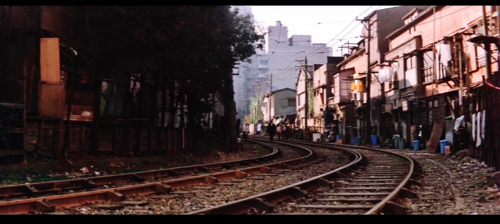
4) Shinjuku Promenade Park 新宿遊歩道公園四季の道
Located next to the famed Golden Gai bar district in Shinjuku, this former streetcar is a a stark change from the way it looked 50 years ago.


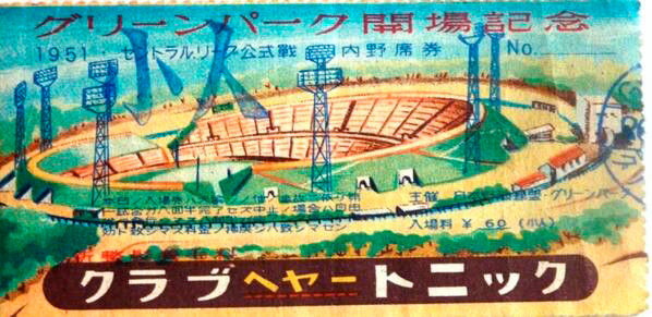
5) Musashino Stadium Line 武蔵野競技場線 (former munitions railway) / Nakajima Airplane Musashino Factory
This line used to serve an airplane factory, and then a short-lived baseball stadium (Musashino Green Park 武蔵野グリーンパーク野球場).
Links:
- Alternate name: Abutment of Industrial Railroad at Nakajima Aircraft Company, Musashi Plant (Ginnan-bashi)
- Blog: 玉川上水(ぎんなん橋)
- Blog: 旧国鉄時代の遺産。武蔵野競技場線の名残、ぎんなん橋
(6) Ojimaryokudo Park 大島緑道公園 (Old Streetcar)
- Google maps (link)
- Post with maps of the old Tokyo streetcar network
- Photos
- 旧城東電車洲崎線跡 (photos)
- 大島緑道公園 (photos)
- Monument and plaza (map):
(7) Shimogawara Freight line Green Road 下河原線緑道 (しもがわらせん) / 東京競馬場前駅跡 下河原線の廃線跡にできた遊歩道 (link)
- Tōkyō Keibajōmae-eki ato Shimogawara-sen no haisen’ato ni dekita yūhodō
- Promenade that could be in the waste line trace of Tokyo Keibajo-mae Station trace Shimogawara line
- Broken link: deliciousway sakura ne jp/eki_2/shimogawara2 htm
- See this area in particular: Streetview
- Old people using the path: Streetview
- Old people and kids here: Streetview
- Kids and family gathering: Streetview)
(8) Musashi-Koyama submerged train track path
Three separate parks:
- Nishikoyama Green Space 西小山緑道公園
- Musashi Koyama Green Park 武蔵小山緑道公園
- Green road park 緑道公園
See: http://linearcityproject.blogspot.hk/2010/08/blog-post_4267.html

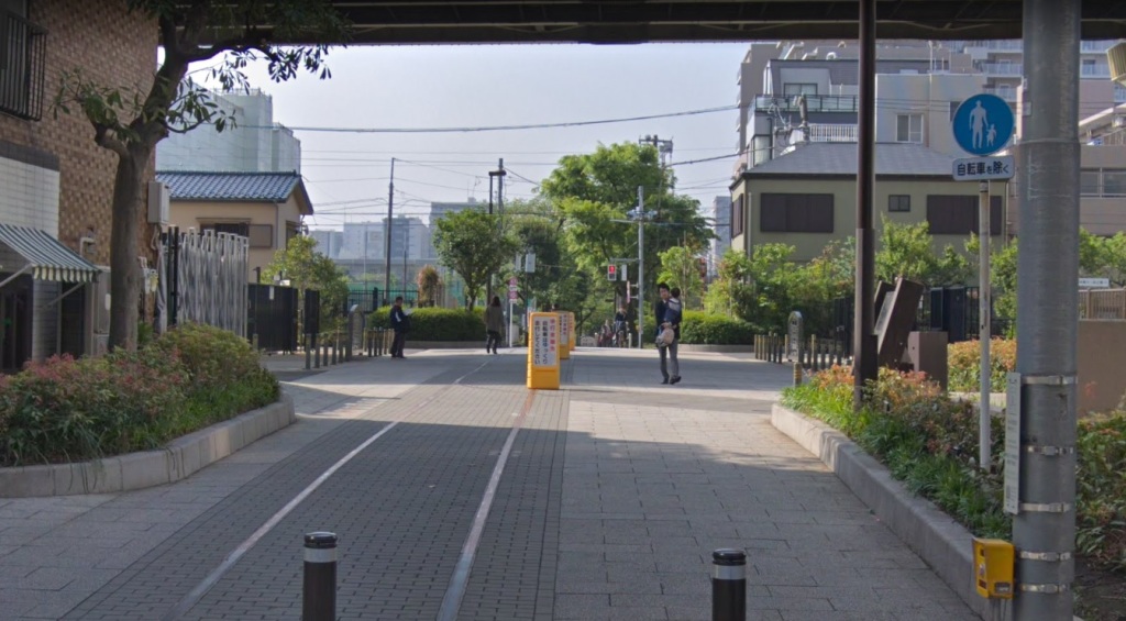
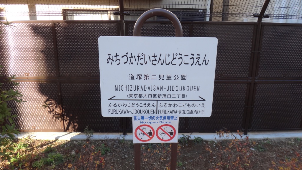
(9) Michizukadaisan jidoukouen 「道塚第三児童公園」 (Ota-ku: 道塚南公園 (map)
This park celebrates its rail theme. It joins with (or replaces) two other parks: Furukawa children’s park 古川児童公園 and Michizuka Minami Koen 道塚南公園 .


(10) Tamagawa Electric Railway (former) 玉川電気鉄道 (Tamagawa Denki Tetsudo)
Mostly tree-lined shopping and residential street…but nice… (here, for example) (and here). Per this source, “In 1907, the Tamagawa Electric Railway began a tram service from Shibuya to Futakotamagawa on the Tama River, which separates Tokyo from Kawasaki to the southwest. Around that time, Shibuya Station was a small brick building with a tower, not unlike the present Harajuku Station on the JR Yamanote Line, and many of its passengers would arrive and depart by rickshaw.”
Old photos of the area (source 1, source 2):


Map of the route from the 1930’s (source):

Along the route is the tiny but pleasant museum: 玉川 大勝庵. You can see entrance here: (Streetview).
(11) Tateno Ryokuchi Park たての緑地
Appears to be the waste line of an old factory: Nakajima Aircraft Company 中島飛行機株式会社. Described as:
- 「たての緑地」 = “Vertical green space”
- 緑地・道 = Green space, road / green road
- 歩行者自転車道 = Pedestrian bike path
Links:
- Great blog: 中島航空金属引き込み線の廃線跡をたどる
- This is a nice spot: Streetview
- Another nice spot: Streetview
- Simple entry, not much info
- 番外編:旧中島航空金属田無製造所専用線跡(たての緑地) (Former Nakajima Aviation Metal Tanashi Factory Dedicated Line Remains)
- Per this blog: 中島航空金属田無工場と西武池袋線(当時の武蔵野鉄道)を結ぶ専用線の廃線跡だそうです。 Nakajima aviation metal Tanashi factory and the Seibu Ikebukuro Line seems to waste line trace of a dedicated line connecting the (Musashino railway at the time).

[…] Tamagawa Electric Railway 玉川電気鉄道 (former […]
[…] Similarly, the railroad tracks that moved cargo across this part of the waterfront now are used by pedestrians as they stroll from Sakuragicho Station to the Red Brick Warehouse (map). (For more about this, and other pedestrian paths built over former train tracks, see: ‘High Lines’ and Rail Trails of Tokyo. […]
[…] See #10 in the following post: Map: ‘High Lines’ and Rail Trails of Tokyo […]
[…] Map: ‘High Lines’ and Rail Trails of Tokyo […]
[…] on the map, but located near the ‘Shibuya –>” arrow is Log Road Daikanyama ログロード代官山, a shopping and walking path built on the site of the old Toyoku Line […]
[…] Just a short walk from here is Michizukadaisan jidoukouen 「道塚第三児童公園」 (map), a park built on top of old train tracks. See: Map: ‘High Lines’ and Rail Trails of Tokyo […]
Reblogged this on the tokyo files 東京ファイル and commented:
Paths and walking trails built on the site of former train tracks.
[…] an old train line along the Yokohama Waterfront, just steps away from Sakuragicho […]